Hyperspectral imagery from airborne sensors is a useful tool for mapping coastal benthic habitats and offers the potential to provide routine monitoring of vulnerable coastal habitats at high spectral, spatial and temporal resolutions necessary for informed management of these resources. New research is required in sensor technology and algorithm development to make the methods robust and applicable to diverse habitats without considerable foreknowledge.
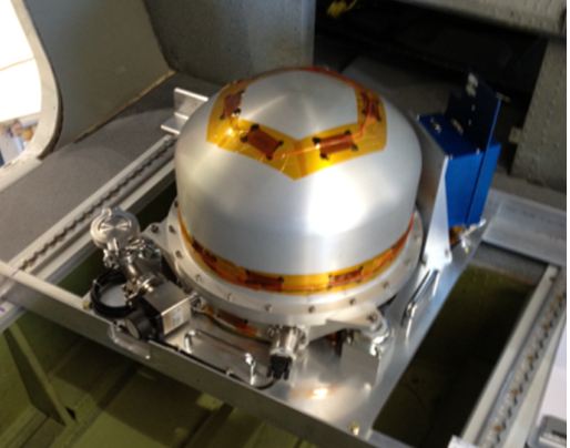
- -Portable Remote Imaging SpectroMeter (PRISM)
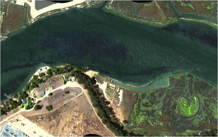
The PRISM sensor built in collaboration with NASA’s Jet Propulsion Lab is an ultra-violet to near-infra-red (350-1050nm) instrument with a spectral resolution of 3nm and a maximum spatial resolution of 30 cm. It has been designed and optimized for imaging dark water coastal targets. In addition, the sensor package contains a two channel spot radiometer in short wave infrared wavelengths (1240 nm and 1640 nm) that is co-aligned with the main PRISM spectrometer primarily for purposes of atmospheric correction. The PRISM sensor was successfully integrated on a Twin Otter platform. Field validation occurred in the study area of Elkhorn Slough and the surrounding area of Monterey Bay California, which provides a wide variety of aquatic and terrestrial coastal habitats for remote sensing.This research is a collaboration between the University of Connecticut and the NASA Jet Propulsion Laboratory and Naval Research Lab. Individuals from NASA Ames, University of California Santa Cruz, Monterey Bay Aquarium and Research Institute and Moss Landing Marine Laboratories also contributed to the field validation efforts.